
It was only a 30 km ride from Pointe-Noire to the border. The road was not as good as what we were used to from Congo, it had a few muddy parts and some deep potholes, but we were actually thankful for the change. At the border post, everything went smoothly. Some ladies wanted to sell us some vaccination certificate we knew we wouldn’t need on the other side – and then we were free to enter the Angolan exclave Cabinda.
Cabinda immediately had a different vibe than Congo, mostly because of the language: Angola was colonized by Portugal. Portuguese remains the língua nacional, spoken by 85% of the people in the cities and 50% of those in rural areas. For us, it meant our ability to communicate diminished drastically. From now on, it was a mix of Spanish, English, hands and feet.
From its independence in 1975 until 1992, Angola was self-declared socialist state: The People's Republic of Angola. In this time, Angola had a lot of support from the USSR and Cuba. Traces of this were still visible in Cabinda. Not only did we see some Cuban education institutions, but also some good old Plattenbauten.


Cabinda is sandwiched between Congo-Brazzaville and DRC. We wanted to avoid DRC because of security concerns and the high price of the visa. There is a way around it: ferries go from Cabinda to Soyo and Luanda on the mainland.
The thing about those ferries: you never know when they’re going. We were in close contact with the ferry company, but they didn’t know the timetable either or to which city the next boat would go to. A day of waiting passed, but no new information came in. On our second morning in Cabinda, it started to rain cats and dogs. It was worse than what we had seen in Pointe-Noire: this was proper tropical thunder and lightning. The gutters couldn’t cope and created rain curtains, the driveway of our hotel filled up too. This was the time we got a message from the ferry company: Please come to the ferry now, it’s leaving. We packed our bags, loaded the bikes and rode through a town that was standing still: the streets had turned into lakes. The little oncoming traffic created waves, and we were thankful for the few cars in front of us as they gave some indication on where to ride.

Boarding the boat was quick, securing the bikes not so much. But eventually, we got there.

We were the only passengers on the ship – all others had taken a catamaran (that cannot take motorcycles (because the crane to unload it is broken)). And we were lucky: we had read about one motorcycle traveller who was stuck in Cabinda for two weeks because no boat was going.


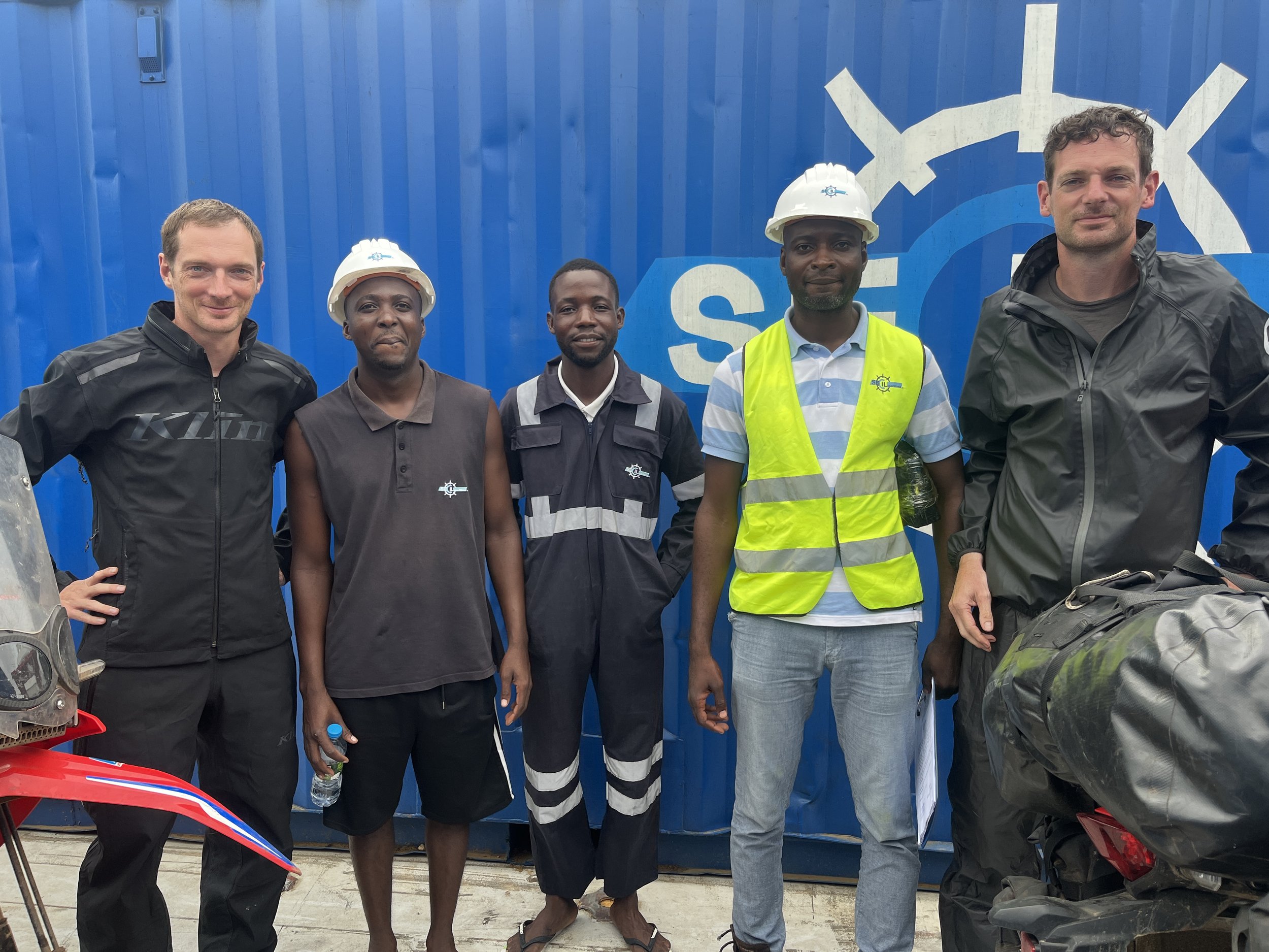
After about three hours along the coastline that was dotted with oil platforms, we made it to Soyo. We offloaded the bikes and took an offloading photo.
It had rained in Soyo too. The streets here looked like the ones we had seen in Cabinda. In this case it was possible to ride on the sidewalk to avoid wet feet.

From Soyo, we took the road south. It didn’t rain. The road was great and: we finally got to test our bikes. The torque was back, the power was back – the guys in Pointe-Noire had done a great job.

Our first stop after Soyo was in Barra do Dande, a town that immediately won us over with its beach, the palm trees and good seafood.


What you see above is the local headquarter of Angola’s reigning party MPLA. We saw their buildings, logos, shirts throughout the country – the party’s been in power since 1975.

We continued south and went around Luanda and its 9 million people. There had been so many big cities on this trip (Dakar, Abidjan, Accra, Lagos, Douala…) that we felt we could do without the traffic and everything that comes with it.

Instead, we rode through some spectacular landscapes.

But it was not only the scenery we enjoyed: at least as important was the climate. It was cooler than before. Significantly cooler. For the first time in months, we didn’t finish our rides drenched in sweat with the urge to take a shower immediately.
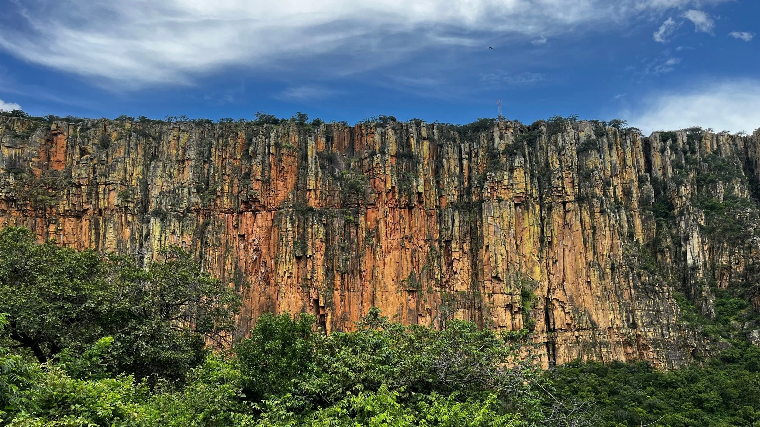
The road from Beguela to Moçâmedes was incredibly beautiful and to our delight a good share of it was unpaved.

On the first 50 kilometers, the area felt really desolated, we hardly saw anyone on the road. The perfect place for a puncture – a first on this trip. Thies’ rear tire was flat.

To our luck, a truck had stranded just 100 meters from us. The guys were waiting for parts to arrive – so they came over to help us.


José (in the brown shirt) really knew what he was doing. If we had fixed it without his help, it would have taken us at least twice as long. After about 45 minutes we were ready to go again, using a spare tube we had carried with us.

Back on the asphalt, the landscape was still spectacular.

We rode 400 kilometers that day. Moçâmedes was previously called Namibe but was renamed in 2016 – all road signs outside of the city still carried the old name though.

When we left Moçâmedes, we also left the coast and went east towards Lubango. For a long time, the road leads up straight to the mountain range Serra da Leba before winding up steeply.

Serra da Leba features Mount Moco, at 2.620 metres the highest mountain in Angola. It seemed like cows enjoy a good view, too.


At its highest point, the pass is at 1.845 meters.
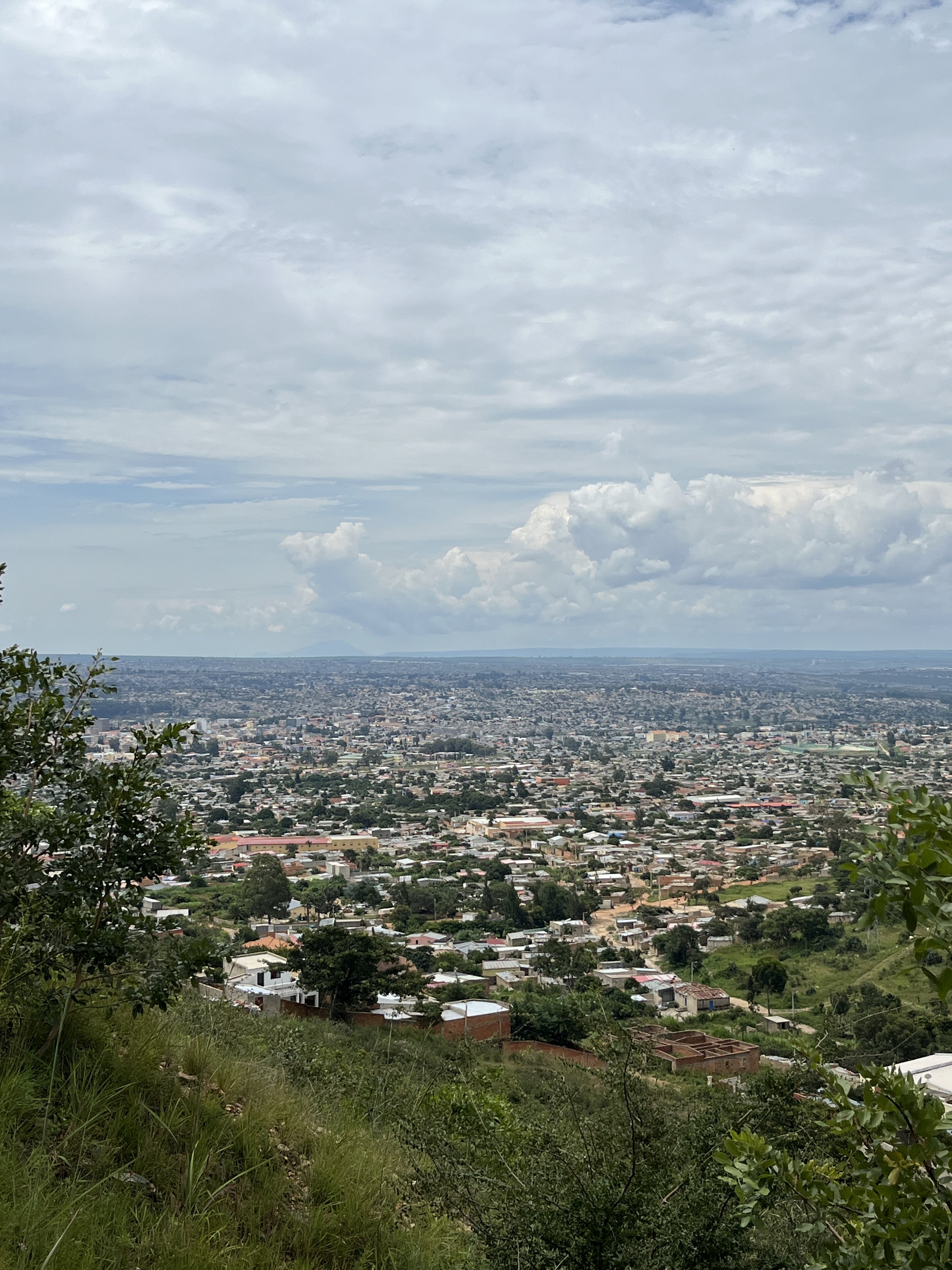
From there, it’s only a short ride down to Lubango, that has an altitude of 1,720 meters – nice and cool.

When we left Lubango, we had to put on an additional layer of clothing for the first time since Morocco. 19 degrees seemed really chilly to us.
The landscape was not as diverse as it had been the days before. It was mostly flat and green, a few swamps here and there. Apart from the occasional pothole, it was animals that demanded our attention. In an effort to get to the only sheep that had not crossed the road yet, a shepherd dog almost ran into Momme’s bike. Thies nearly crashed into a calf that ran across the street to close up to its mother.

From time to time, we also saw some rusty abandoned tanks on the side of the road. Angola’s history is a violent one: after getting rid of Portuguese colonial rule and gaining independence in 1975, the land slid into a civil war between a party called UNITA and the aforementioned MLPA. It is widely considered a Cold War proxy conflict, but lasted until 2002. The tanks were the only relict we saw, while many remain invisible: land mines are still a problem in rural areas.

Our last stop in Angola was Ondjiva. We routinely checked the bikes, but everything was fine. Time to put up the mosquito nets.

We didn’t really know what to expect beforehand but… Angola was the pleasant surprise of this trip so far. The food was good. The people were friendly. The roads were good, but not too good – and you can always take an unpaved detour. It’s a huge country – and we certainly didn’t explore it to the degree it would have deserved. The main reason for this was the rainy season that lasts until April. We’d like to come back one day to see more – but don’t tell anyone: It’s a Geheimtipp.